
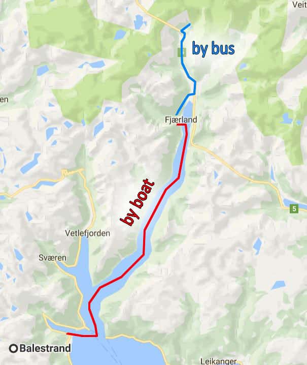
Awakening with the 0500 (5:00 AM) sunrise, we were excited about the day’s adventures. After a delicious breakfast at our hotel, we had time for a good, long hike into the mountain forests around Balestrand. Then we would catch the ferry to Fjærland, to visit the Jostedal Glacier.
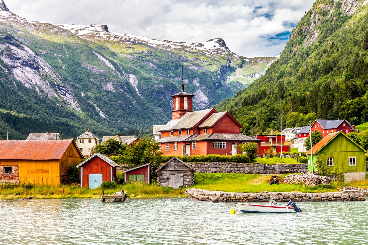
 Fjaerland is a village on a tributary of the Sognefjord and is also known as the village where fjords meet glaciers. It is here that you can get up close to Jostedalen glacier, the largest glacier in Europe.
Prior to 1986, Fjaerland was only accessible by water. It was in that year a tunnel was opened connecting Fjærland to the northwest. Then in 1994, another tunnel was opened to the southeast. Along the way, we were informed that the paternal grandparents of Walter Mondale, 1984 US presidential nominee, were born in Fjaerland.
 But getting there was at least half the fun – the nearly 2-hour trip took us through even more beautiful fjord scenery.
Disembarking at the dock in the village, we boarded a bus to take us first to the Norwegian Glacier Museum before the short drive to the Jostedal glacier.
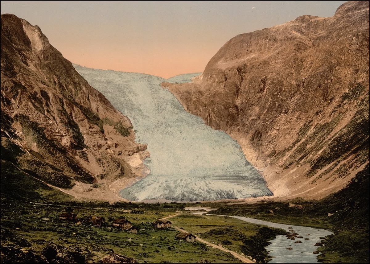 Jostedal Glacier is the largest glacier in continental Europe, having a total area of 487 K2 (188 mi2) and a maximum thickness of 600 m (2,000 ft). It has around 50 glacier arms, branches of the glacier reach down into several valleys including here at the Bøyabreen face. However, globally glaciers are losing ice at an extensive rate, and Jostedal is no exception. In 2014, the glacial arm Bøyabreen lost 65 m (215 ft) of ice in a few months.
 From the bus, it was a short walk to view the remains of the glacial face, although there is a tremendous amount of glacier beyond where we were. The cloudy melt-water formed a small lake before it made its way to the Fjaerland Fjord. Fine particles of rock cause the cloudiness of the water as a result of the grinding away of the mountains by the tremendous pressure of the glacier.
 The visit to the glacier was short, but we still had to return by ferry to Balestrand, collect our luggage, and board the express boat for the almost 5-hour trip back to Bergen. We wouldn’t get back until 2045 (8:45 PM) but since the sun wouldn’t set until 2230 (10:30 PM) we would be able to enjoy the scenery and still have daylight for the walk home from the pier.
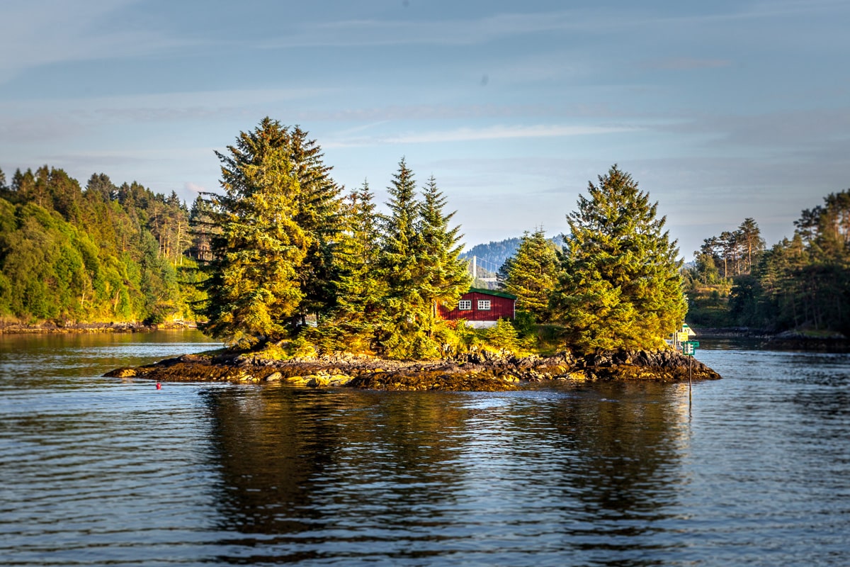 The landscape changed as we approached the western coast. Dramatic mountains and fjords gave way to a network of thousands of rocky islands and passages. Though not as striking, the route was nonetheless beautiful. Colorful cabins, numerous little lighthouses, and small fishing villages dotted the landscape as the shadows of the long summer day stretched across the water.


Evelyn S.
4 Dec 2016I’m amazed that the glaciers look so mountainous. I always envisioned they would be flat on top. What kind of tree was that beautiful batk from?
cathi
30 Nov 2016The water shots are stunning.
Linda
30 Nov 2016Absolutely spectacular. Thanks for the journey.
Wayne
29 Nov 2016Spectacular. Your photos added a new place for my bucket list!
Missy Ortega
29 Nov 2016I really enjoy the journey and the utilizing the map that you offer is a treat !
Alice Mathias
28 Nov 2016It just keeps getting better and better!
Bruce Martin
28 Nov 2016Beautiful. Thanks for the tour.